The Mayo Pink Ribbon Cycle offers participants a choice of 3 super and well loved routes – 52km, 70km or 110km.
All routes will start together and follow the same road for the first 17km.
All routes take in areas of natural beauty and will bring cyclists through many of the towns and villages of Mayo.

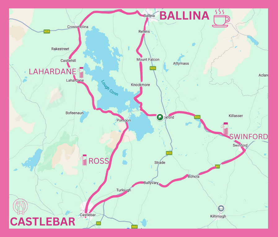
This route starts at The Atlantic Technological University (formerly GMIT) Castlebar. Cyclists will head out the N5 Dublin road for 25km. It then turns left and enters the market town of Swinford. From there it’s a 13km run past the beautiful Callow Loughs to the historic town of Foxford situated on the banks of the river Moy. After Foxford the route turns left in the direction of Pontoon and passes the famous lakes of Lough Cullin and Lough Conn en route to the village of Knockmore. From there it’s a 10 km spin into the town of Ballina. From there the route takes us to Crossmolina, on the north shore of Lough Conn. After Crossmolina comes the village of Lahardaun, where proportionately more people lost their lives in the Titanic disaster than from anywhere else in the world. 11 men and 3 women left the village to make their way to a new life in America in 1912. Only 3 survived. The village has a tranquil memorial park where tired cyclists might like to take a moment to pause and remember. After that cyclists come to Pontoon, the meeting point of stunning Loughs Conn and Cullin. From there it’s a scenic run through Ross and Crimlin then back to Castlebar.
The route has a total ascent of 665.9 m and has a maximum elevation of 85.29 m.
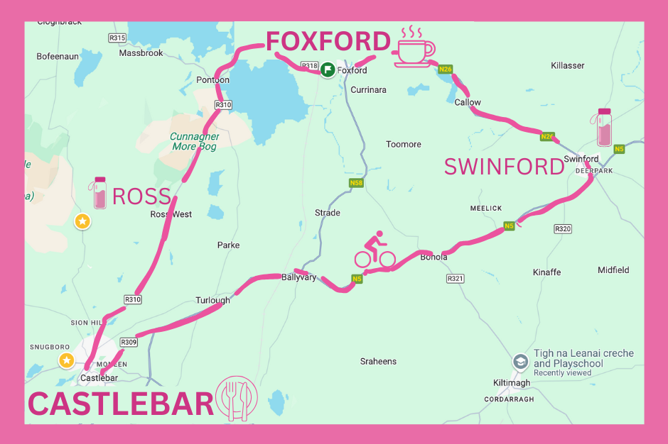
This route starts at the Atlantic Technological University (formerly GMIT) Castlebar. Cyclists will head out the N5 Dublin road until the town of Swinford. They then turn left for the historic town of Foxford situated on the banks of the river Moy. After Foxford the route turns left for Pontoon taking cyclists between the magnificent lakes Lough Conn and Lough Cullin. From there it’s a scenic run through Ross and Crimlin then back to Castlebar. This is a very enjoyable route and all cyclists should find it manageable with the appropriate training.
The route has a total ascent of 385 m and has a maximum elevation of 70 m.

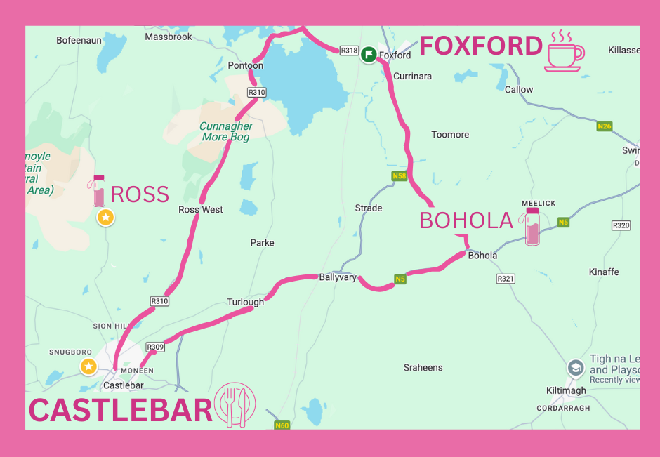
This route starts at the Atlantic Technological University (formerly GMIT) Castlebar. Cyclists will head out the N5 Dublin road until the village of Bohola. They then turn left for the historic town of Foxford situated on the banks of the river Moy. After Foxford the route turns left for Pontoon taking cyclists between the magnificent lakes Lough Conn and Lough Cullin. From there it’s a scenic run through Ross and Crimlin then back to Castlebar. This is a very enjoyable route and all cyclists should find it manageable with the appropriate training.
The route has a total ascent of 301.23 m and has a maximum elevation of 68.56 m.
